

Planetary Geodynamics Laboratory
Two Columns
Topography and Surface Change
Laboratory staff involved in topography and surface change studies
|
|
| David Harding |
Jeanne Sauber |
Lidar
Different uses of Lidar
|
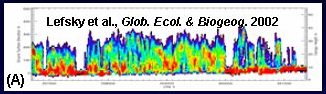
(A) Canopy height and density derived from lidar mapping of forests (D. Harding). |
|
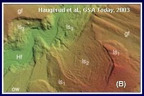
(B) With forest cover removed, landslides of different ages are revealed in the Puget Sound (D. Harding). |
|
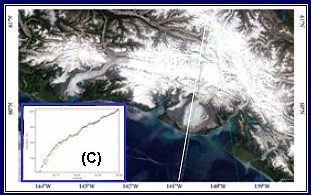
(C) ICESat repeat tracks can be used to determine the thinning of Alaskan glaciers over time (J. Sauber). |
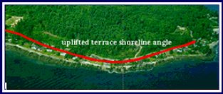
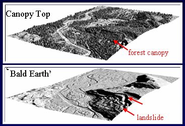 Lidar's advantage over microwave altimetry: the canopy return can be separated from the "bald earth" ground return, revealing fault scarps (above), uplifted terraces (below) and other indicators of possible seismic hazards (D. Harding, J. Muller)
Flight mission support
|
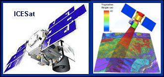
Flight mission support activities include calibration/validation and science team activities for ICESat (above, left, D. Harding, J. Sauber) and possible future dynamic elevation lidar system concept development (above, right, D. Harding) |
|
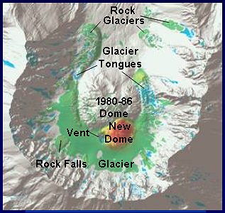
Aircraft lidar measurements of the summit area of Mt. St. Helens were repeated after the recent activity in Fall 2004. Comparison with similar measurements in 2003 show growth of a new dome just to the south of the 1980-86 dome (D. Harding). |
+ Home