 |
David Harding was particularly active at the recent AGU meeting in San Francisco. He gave an invited paper, "Method for Hydrologic Monitoring" in the special session ICESAT: New Light on a Changing World, and then represented "Land Applications" at a follow-up ICESat press conference. He was also a co-author on seven other papers at the meeting, which are listed below. |
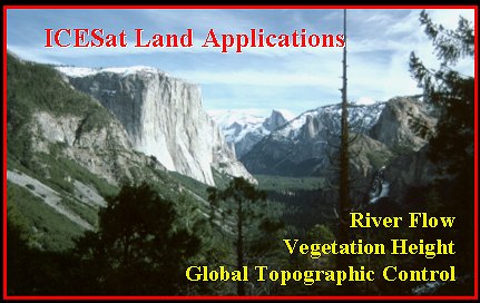
In his own paper and again at the press conference, Harding showed examples of how "ICESat is a pathfinder for globally-distributed, highly-precise lidar measurements of changing river height & slope". ICESat profiles from the lower Mississippi are shown below.

Papers Co-Authored by Harding at the Fall 2004 AGU Meeting:
"ICESat Validation of SRTM C-Band Digital Elevation Models" Carabajal, C C
"Estimating forest canopy height from Geoscience Laser Altimeter System waveforms and Shuttle Radar Topography Mission digital elevation models" Lefsky, M A
"Recent Results in ICESat Geolocation Parameter Calibration From Range Residual Analysis" Luthcke, S B
"Evaluation of LiDAR Imagery as a Tool for Mapping the Northern San Andreas Fault in Heavily Forested Areas of Mendocino and Sonoma Counties, California" Prentice, C S
"Southern Alaska Glaciers: Spatial and Temporal Variations in Ice Volume" Sauber, J
"Lidar measurement of topographic change during the 2004 eruption of Mount St. Helens, WA" Haugerud, R A
"Decoupled, localized deformation in the SE crater of Mount St. Helens associated with the 2004 eruption" Poland, M P
Contacts: David Harding, GSFC, David.J.Harding@nasa.gov
 Back to Geodynamics Science Highlights
Responsible NASA official: Dr. Herbert Frey