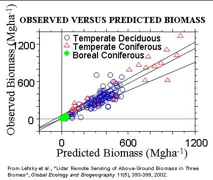
Vegetation height indices derived from LIDAR waveforms have previously been shown to be an accurate predicator of above ground forest biomass for specific forest types. In a recent paper titled “Lidar Remote Sensing of Above-Ground Biomass in Three Biomes”, in the journal Global Ecology and Biogeography (11(5): 393-399, 2002), a team which includes Dave Harding shows that a single predictive relationship is equally applicable to three different forest biomes: temperate deciduous, temperate coniferous, and also boreal coniferous. The paper’s lead author is Mike Lefsky.
|
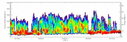
4.7 km SLICER waveform transect of temperate coniferous forest 10 m diameter laser footprints color-coded by plant density |
Contact: Dave Harding, GSFC, Code 921 (harding@core2.gsfc.nasa.gov)
![]()
 Back to Geodynamics Science Highlights
Responsible NASA official: Dr. Herbert Frey