![]()
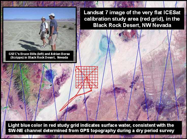
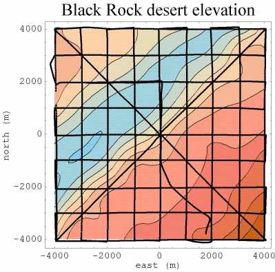
Contoured GPS height data for the study area. Contour interval is 10 cm. Relief is less than 1 m, but is consistent with the Landsat image of a channel.
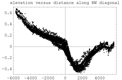
Elevations projected onto a NW-SE line across the channel, which is 0.5 m deep. Origin of the channel is presently unknown..
Contact: Bruce Bills, GSFC, Code 921 (Bills@core2.gsfc.nasa.gov)
![]()
 Back to Geodynamics Science Highlights
Responsible NASA official: Dr. Herbert Frey