Science Lead - David J. Harding (921) (harding@doonerak.gsfc.nasa.gov)
The spatial organization of vegetation canopies is a fundamental boundary condition that influences many ecosystem processes including energy and chemical exchanges, but data on the three-dimensional organization of canopies is difficult to obtain. Most remote sensing systems, although providing images of the horizontal organization of canopies, do not provide direct information on the vertical distribution of canopy elements. Ground observer or in-situ measurements of canopy vertical structure are inherently laborious and time consuming, and thus are usually very limited in scope. Furthermore, measurement of ground topography in densely vegetated areas is not possible using traditional remote sensing methods.
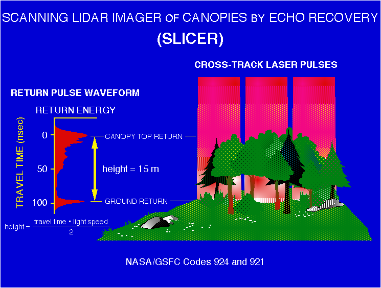
To address these limitations, we have developed an airborne laser altimetry system that provides high-resolution, geolocated measurements of vegetation vertical structure and ground elevations beneath dense canopies. The basis of the method is ranging to the surface obtained by precise timing of the round-trip travel time of short-duration pulses of backscattered, near-infrared (1.06 microns) laser radiation. We digitize, at 11 cm vertical sampling, the complete time-varying distribution of return pulse energy, or waveform, that results from the reflection of a single laser pulse from multiple targets occurring at varying heights within a large footprint. The waveform is a measure of the vertical distribution of vegetation surface area and the underlying ground's height distribution introduced by surface slope and roughness. By using large diameter footprints on the order of one to two times the typical crown widths (e.g. 10 to 15 m), each waveform includes returns from the highest elements of the canopy and from the ground. Ground returns occur where there are sufficient intra- or inter-crown gaps of any size extending at nadir to the canopy floor, which is usually the case in all but the densest canopies. The laser footprints are geolocated by combining the laser ranging data with aircraft position, obtained from a differential kinematic GPS trajectory, and laser pointing knowledge, obtained from an Inertial Navigation System. By scanning the laser footprint across the track of the aircraft flight line, we produce a narrow swath of three-dimensional laser waveform data.


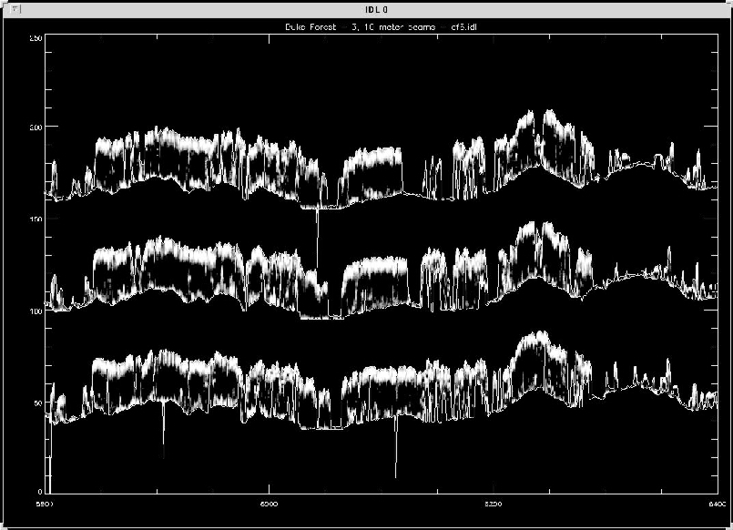
Click on picture for a data plot showing the topography and canopy density returns from SLICER