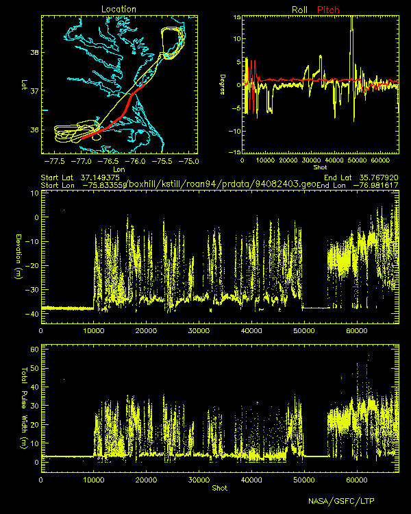
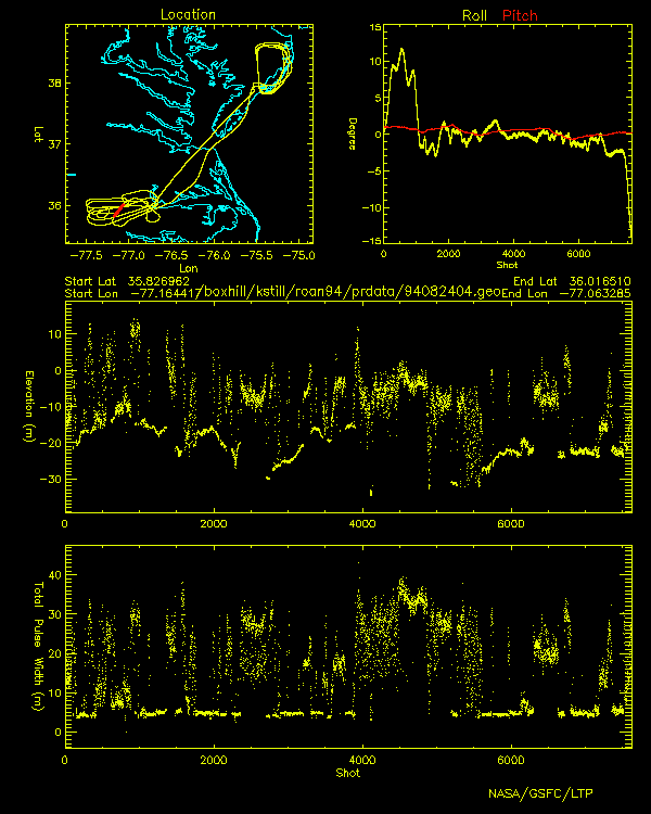
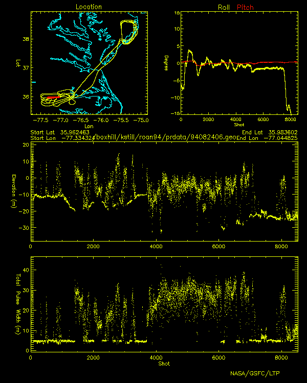
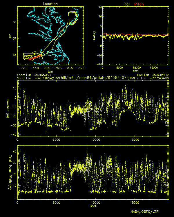
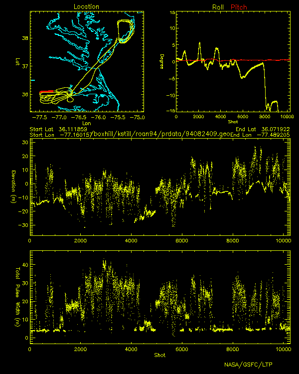
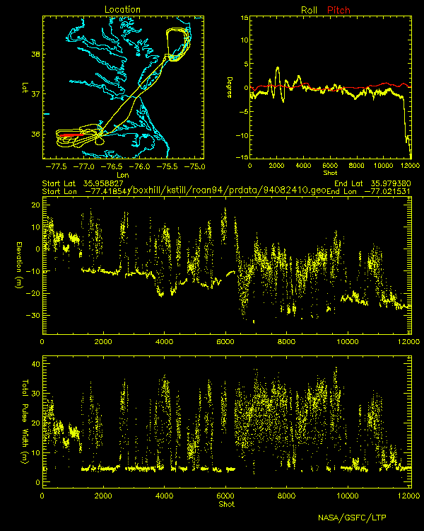
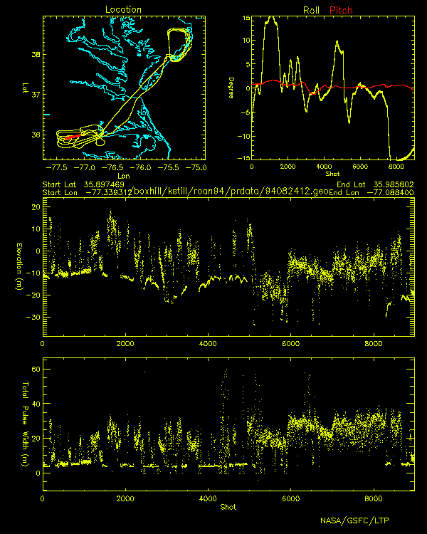
SLICER
Airborne Laser Altimeter
Profiles
Roanoke River August 24, 1994

Click image to view elevation and total pulse width profiles
Profile location shown in red
 |
 |
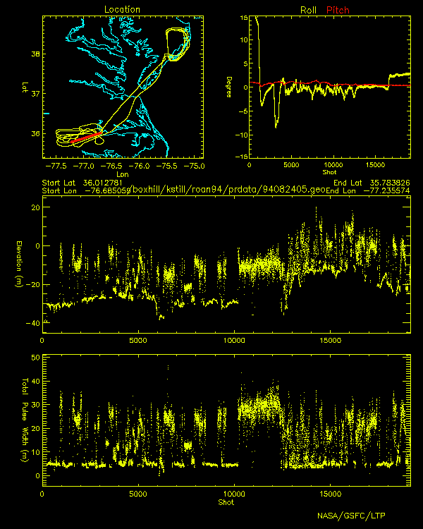 |
| 94082403.gif | 94082404.gif | 94082405.gif |
 |
 |
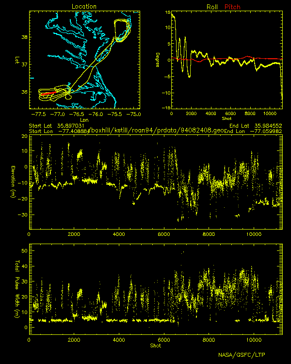 |
| 94082406.gif | 94082407.gif | 94082408.gif |
 |
 |
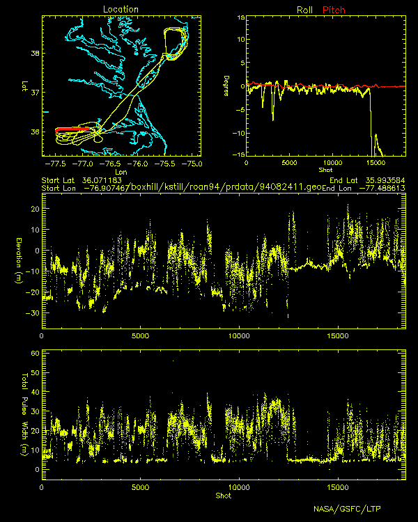 |
| 94082409.gif | 94082410.gif | 94082411.gif |
 |
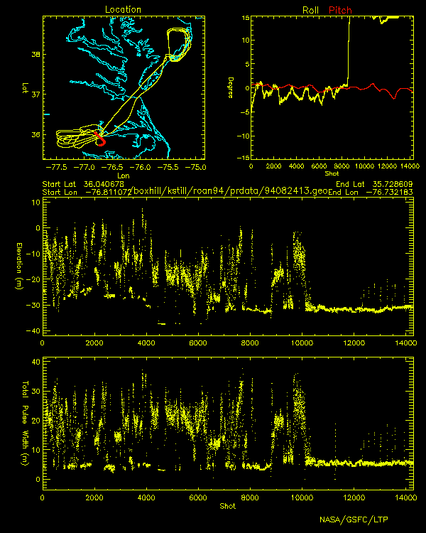 |
| 94082412.gif | 94082413.gif |