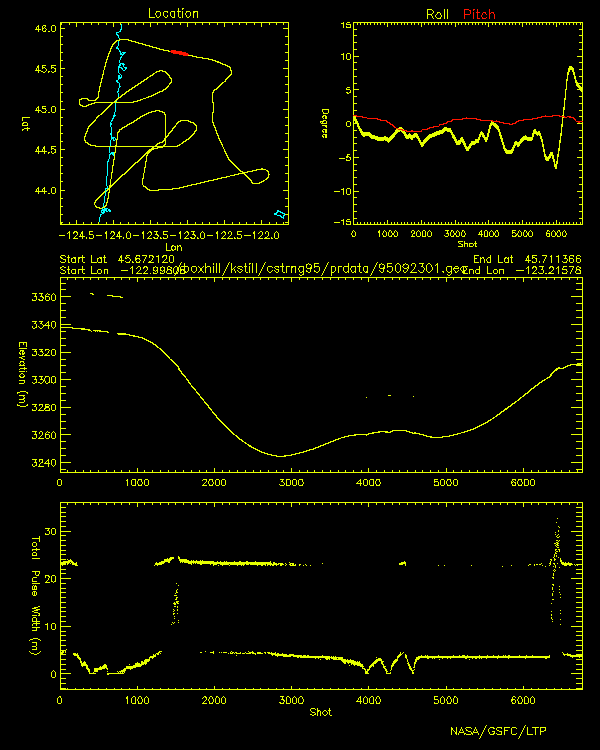
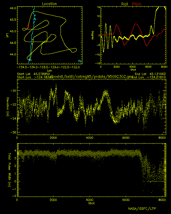
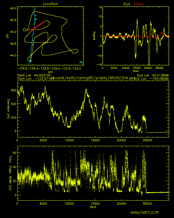
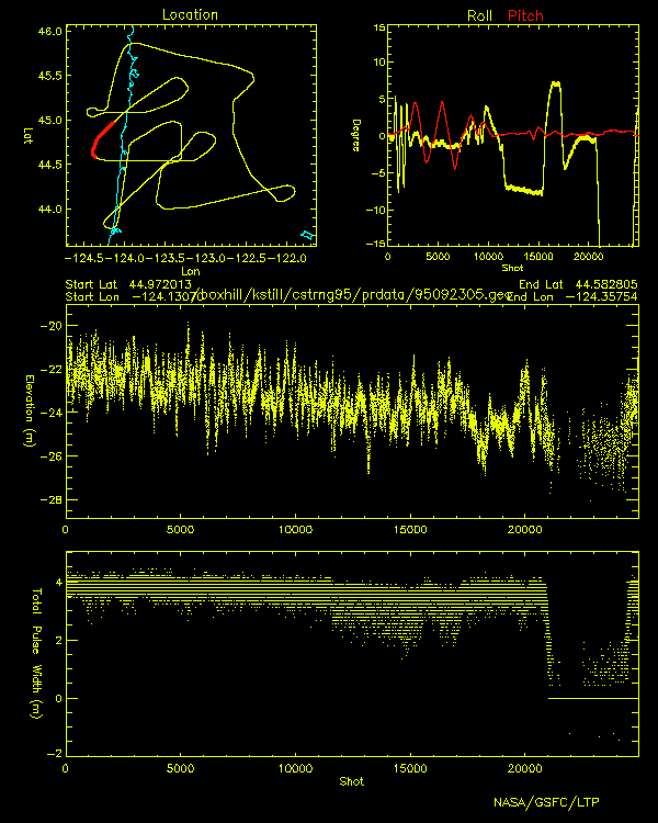
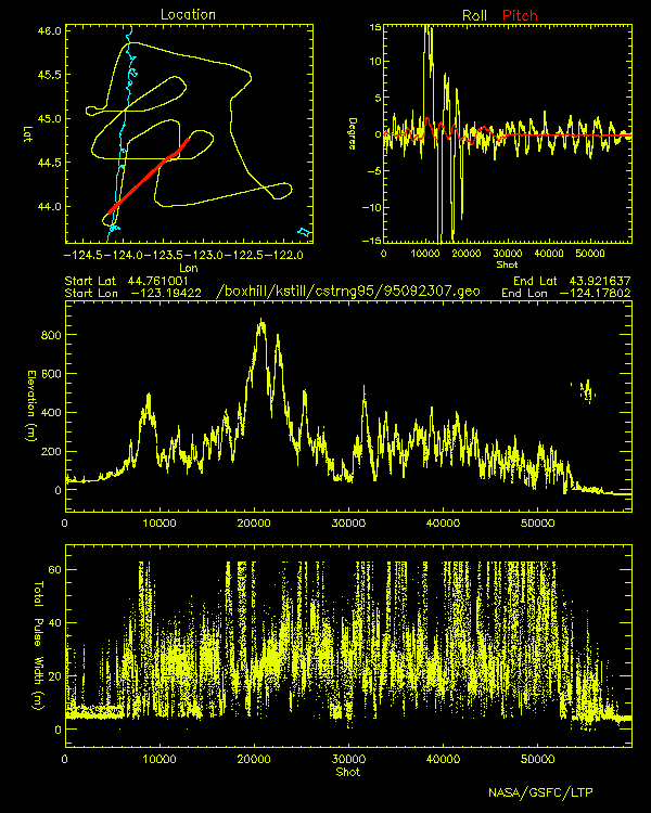
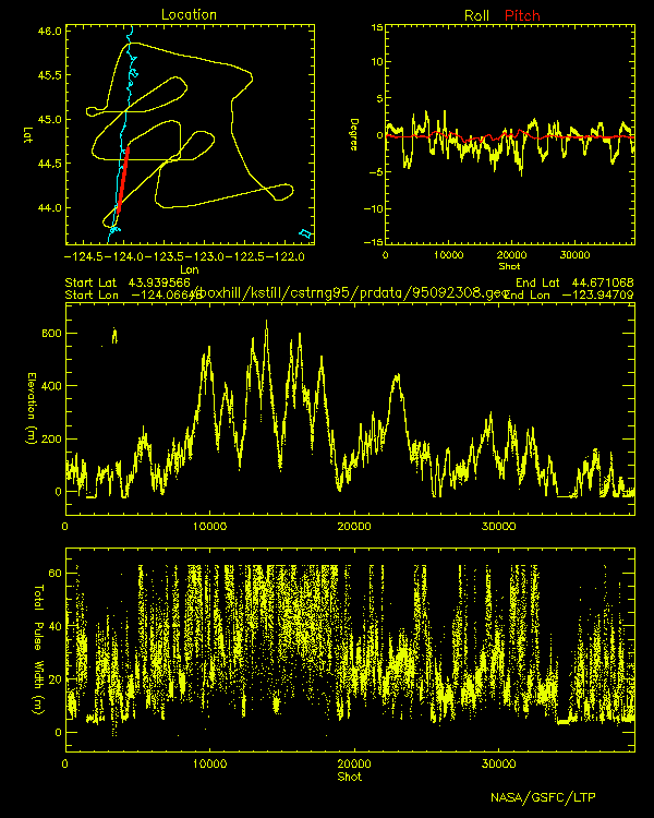
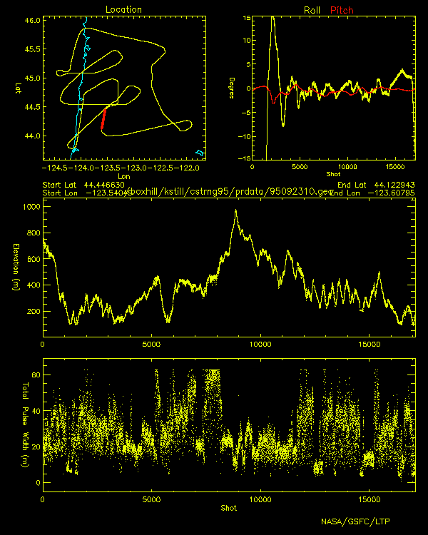
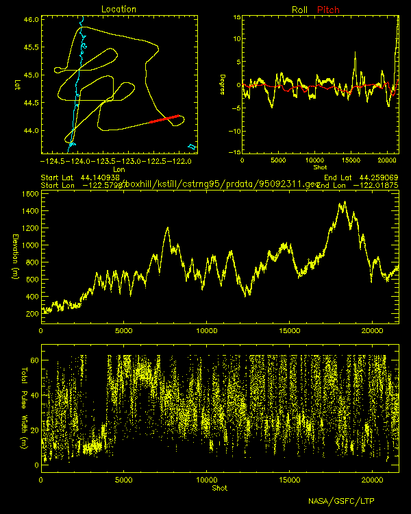
SLICER
Airborne Laser Altimeter
Profiles
Coastal Range September 23, 1995

Click image to view elevation and total pulse width profiles
Profile location shown in red
 |
 |
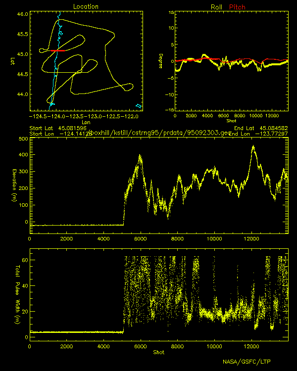 |
| 95092301.gif | 95092302.gif | 95092303.gif |
 |
 |
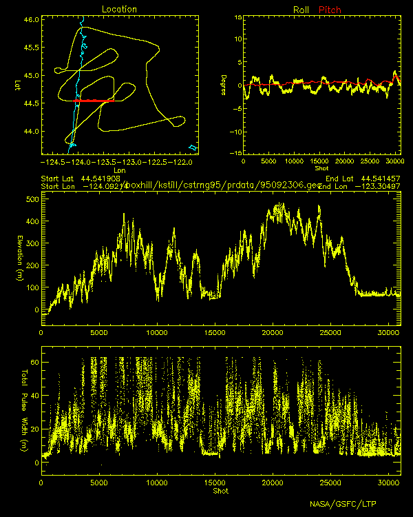 |
| 95092304.gif | 95092305.gif | 95092306.gif |
 |
 |
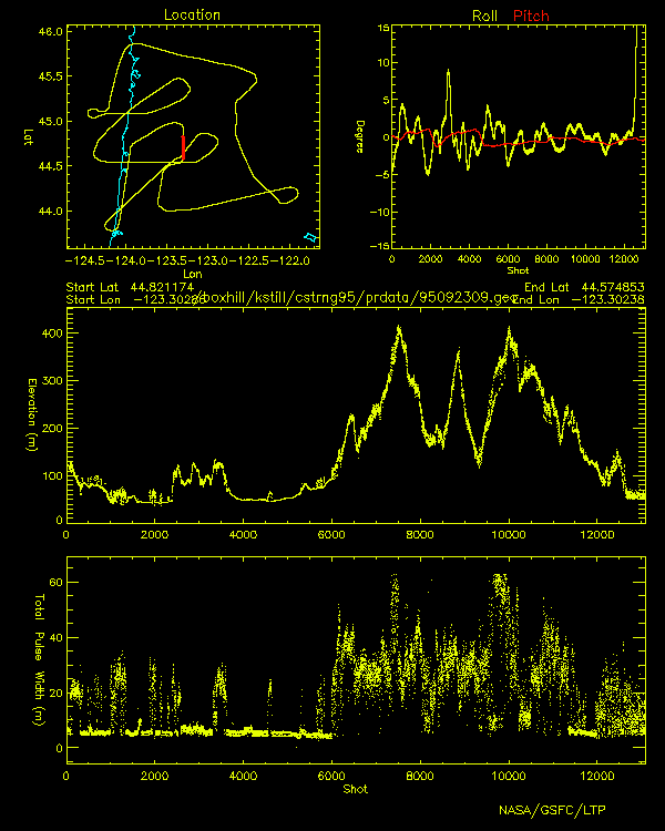 |
| 95092307.gif | 95092308.gif | 95092309.gif |
 |
 |
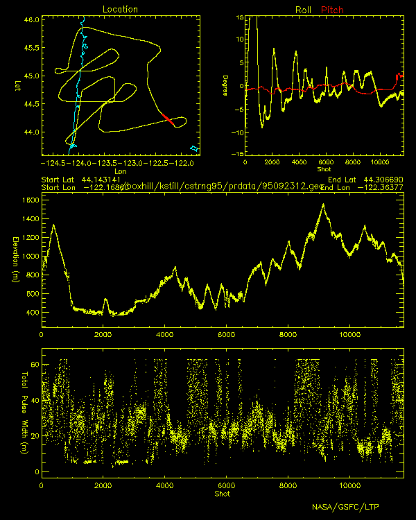 |
| 95092310.gif | 95092311.gif | 95092312.gif |
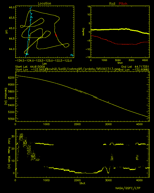 |
| 95092313.gif |