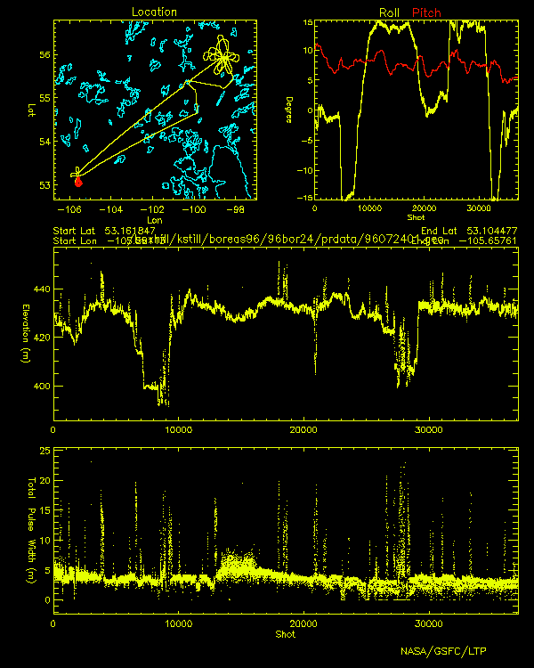
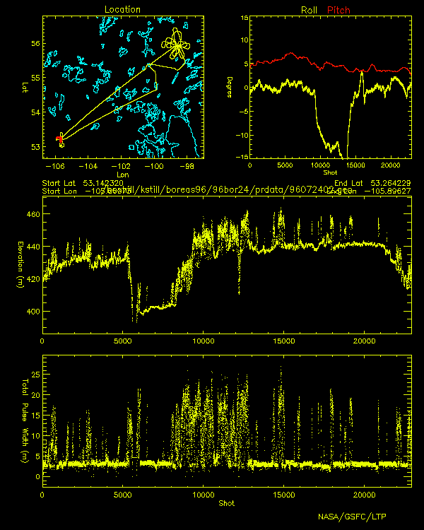
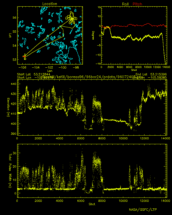
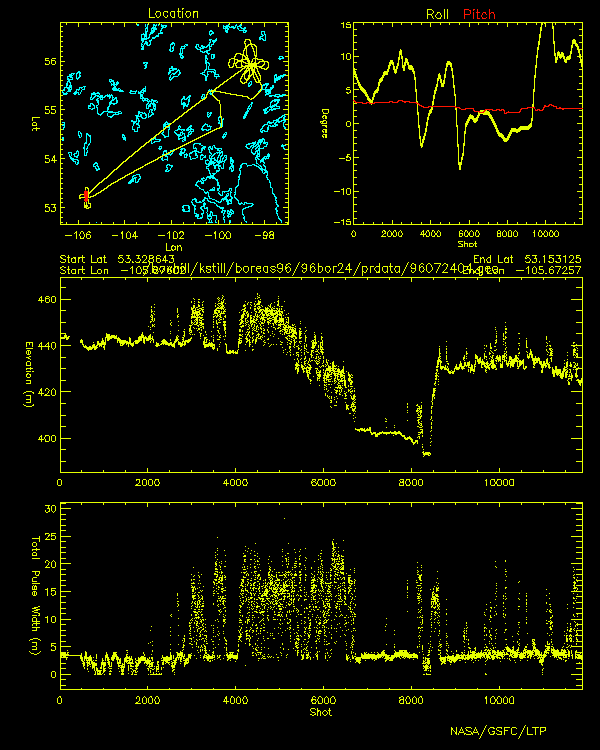
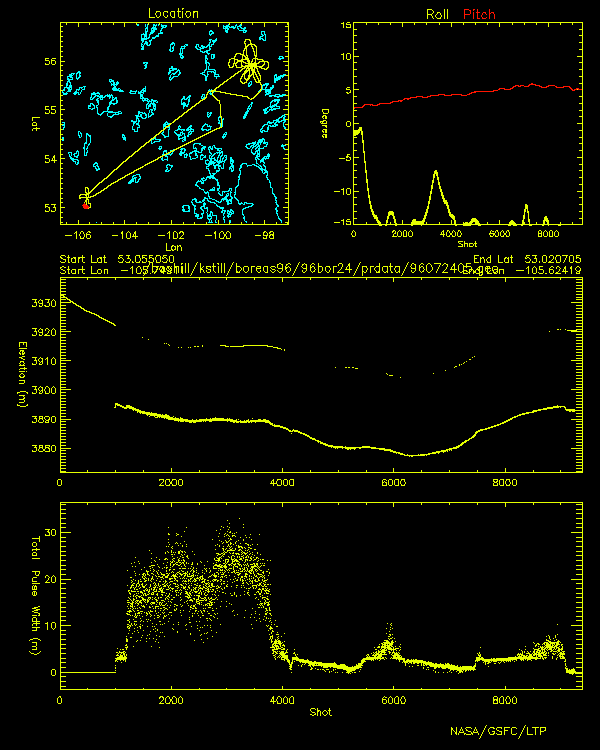
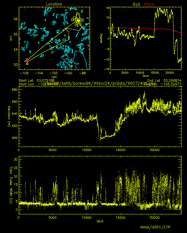
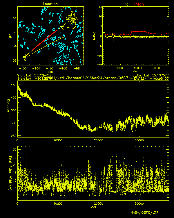
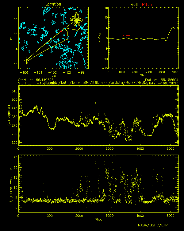
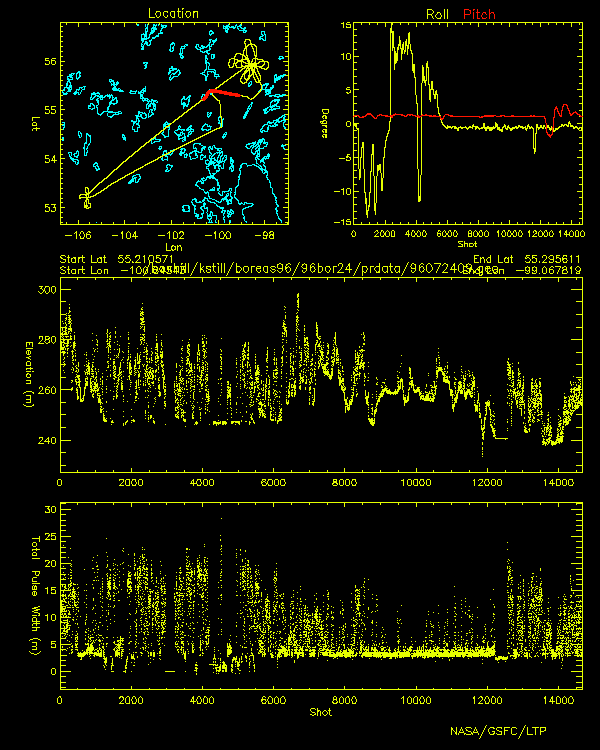
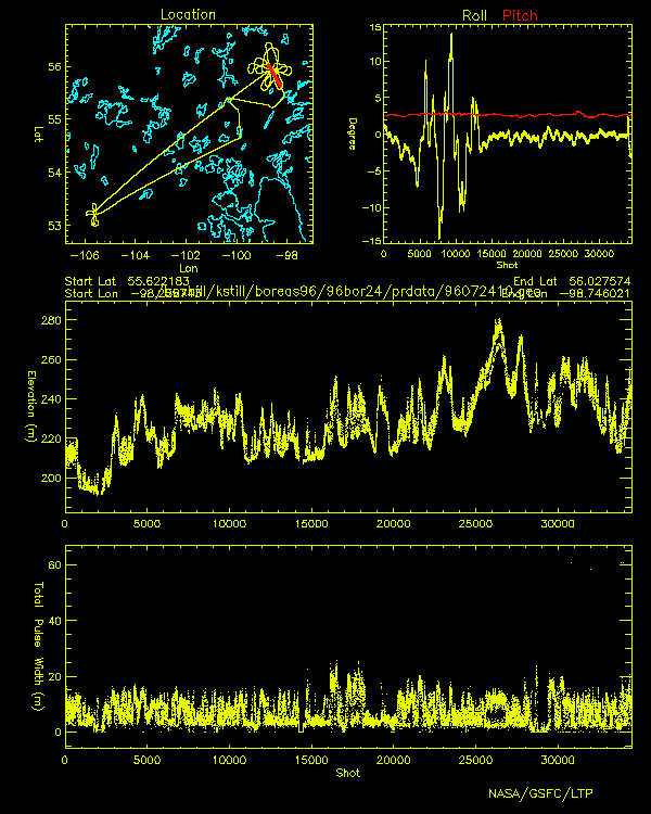
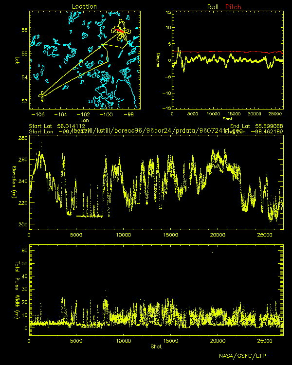
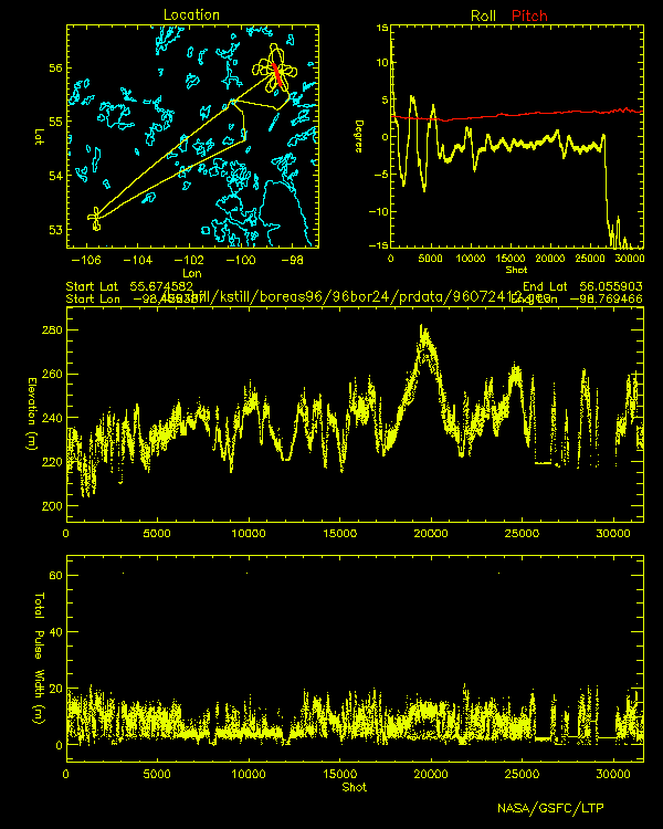
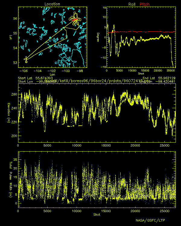
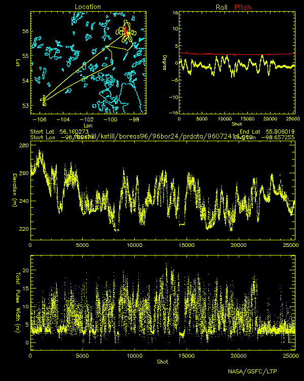
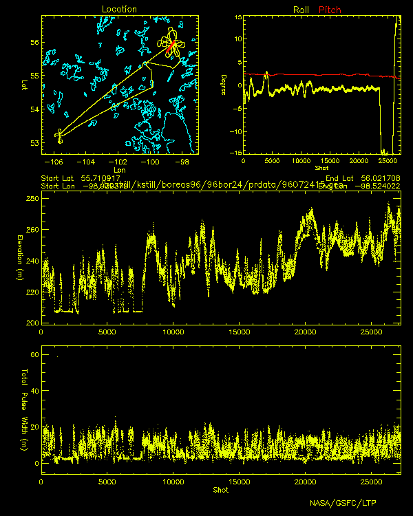
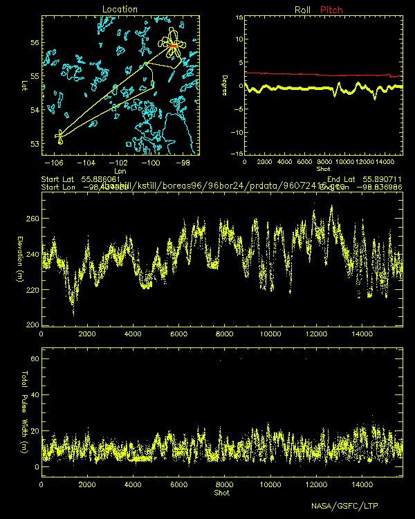
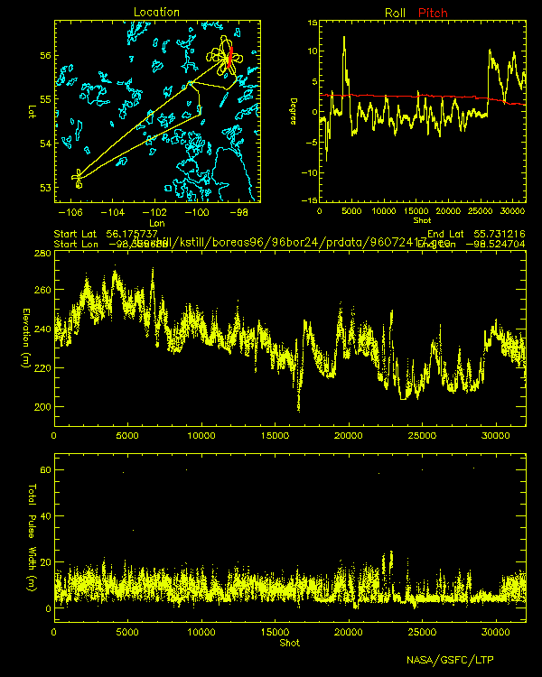
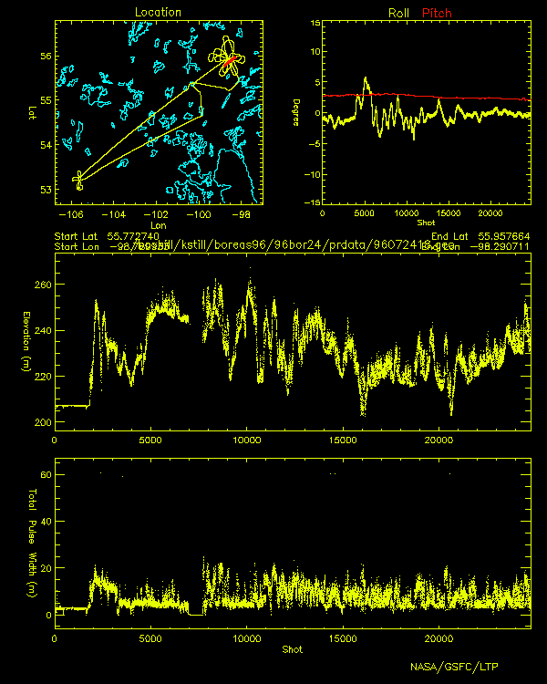
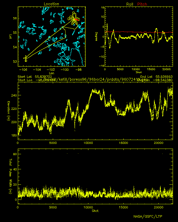
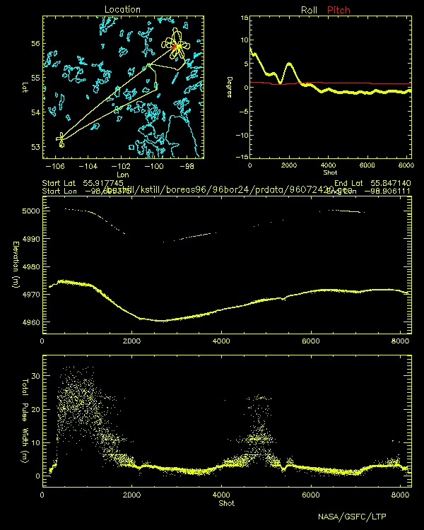
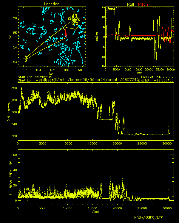
SLICER
Airborne Laser Altimeter
Profiles
BOREAS July 24, 1996

Click image to view elevation and total pulse width profiles
Profile location shown in red
 |
 |
 |
| 96072401.gif | 96072402.gif | 96072403.gif |
 |
 |
 |
| 96072404.gif | 96072405.gif | 96072406.gif |
 |
 |
 |
| 96072407.gif | 96072408.gif | 96072409.gif |
 |
 |
 |
| 96072410.gif | 96072411.gif | 96072412.gif |
 |
 |
 |
| 96072413.gif | 96072414.gif | 96072415.gif |
 |
 |
 |
| 96072416.gif | 96072417.gif | 96072418.gif |
 |
 |
 |
| 96072419.gif | 96072420.gif | 96072421.gif |