SLA Canopy Height
SLA-01 Canopy Height Measurements
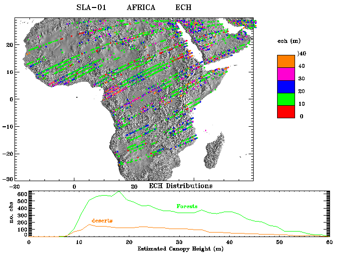
SLA-01 distribution of echoes from which an estimate of
the effective tree canopy assemblage height (ECH) could be derived
superimposed upon a shaded relief rendition of the topography of
Africa. SLA-01 was able to measure the vertical distribution of
roughness in vegetated regions such as Africa about 13% of the time,
on the basis of the multi-gaussian echoes it recorded. The reason
only about 13% (~ 29000) observations resulted in reasonable canopy
height observations is a consequence of SLA's large footprint
and strong signal levels, which resulted in saturated echoes over
heavily vegetated terrain in many instances. However, the tens of
thousands of measurements of an effective canopy height in places
such as Africa is unique and extends the database on vegetation
heights by several orders of magnitude. Histograms at the bottom of
the figures illustrate the frequency distribution of tree heights
versus the total vertical roughness of desert surfaces.
Responsible NASA official: David Harding
Web Curator: Jim Roark (SSAI)
Email roark@denali.gsfc.nasa.gov with comments or suggestions
Last modified July 22, 1997