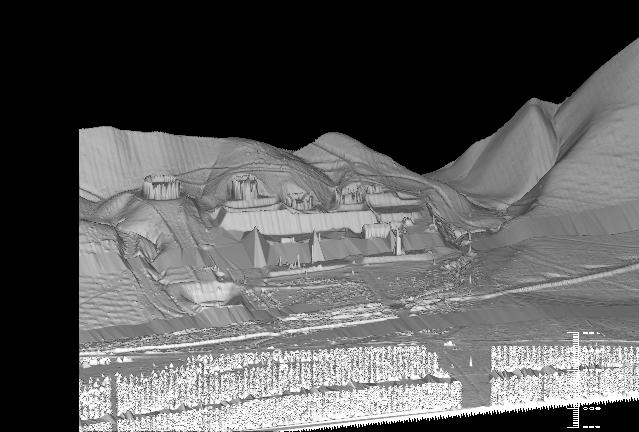
This image comes from the Wheeler Ridge deployment while basing out of
Dryden. In processing the wheeler ridge data, I couldn't help but notice
all of the oil equipment on the slopes while flying the data. In post
processing, the data showed these oil tanks and roads on the side of
the hills. You will notice an orchard at the bottom of the image,
and there is a break in the data near the center of the image. This image
is made from 16 passes flown adjacently to synthetically widen our swath.
This image is approximately 1.2km square sampled at 1 meter spacing in
both directions. You can also see in the left side of the image at the bottom
of the hill, the ridges that are being studied through this data by
Karl Mueller.
Back to the RASCAL IMAGES page...
Return to the RASCAL home page...