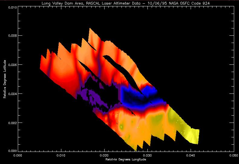
This is the data that the 3d image was made from plotted with elevation
represented by color. The gaps in the data are apparent, and it is
interesting to note that almost no data was collected on the water in front
of the dam (to the left). The water was quite still in the mornings when
the data was taken, and the laser reflected off the lake like a mirror,
resulting in no data returns.
Back to the RASCAL IMAGES page...
Return to the RASCAL home page...