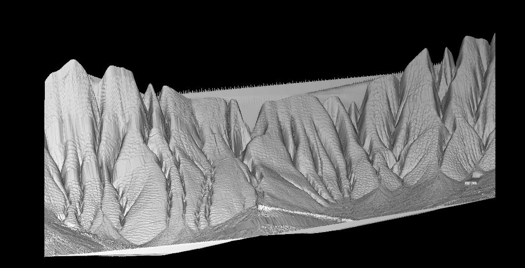
This image covers an area adjacent to the segment 1 data. This image covers
east longitude 240.985 to 240.920. The ridges are the prime feature in
this image, continuing from the last segment. There are some gaps in
this data, but the overall shape of the hill side is well captured, with
high resolution vertical accuracy.
Back to the RASCAL IMAGES page...
Return to the RASCAL home page...