Surtsey Topography
Surtsey Topography
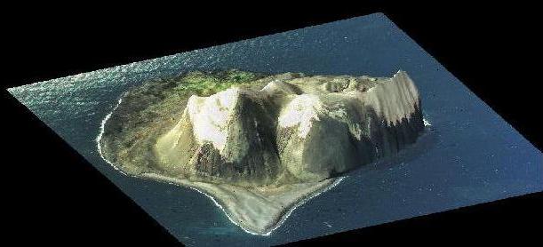
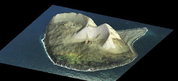
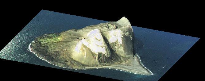
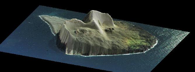
Ray-traced perspective views of the topography of Surtsey,
an island centered at 63 18'N, 20 36'W, off the coast of Iceland.
Airborne Topographic Mapper (ATM) scanning laser altimeter swaths
collected on 22 July 1998 from the NASA Wallops Flight Facility P3
aircraft were used to develop a 3 m spatial resolution digital
elevation model or DEM, on top of which a scanned version of
the National Land Survey of Iceland August 1998 vertical aerial
photograph has been draped. A team of scientists from NASA's
GSFC (J. Garvin, W. Krabill, J. Frawley, S. Manizade), together with
colleagues at the USGS (R. S. Williams, Jr) and Iceland (Dr.
S. P. Jakobsson), are analyzing these new data in an effort to
understand the erosional history and volumetric erosion rate
for Surtsey.
From our volumetric erosion measurements, the survival of
Surtsey as an intact island appears likely at least for the
next 100 years, assuming the pace of erosion is episodic as
it has been over the past 30 years. Future measurements of
the detailed topography of the island with the ATM system
should allow us to refine the short term erosion rate and
better predict the lifetime of the island.
Special thanks to the National
Land Survey of Iceland (i.e. Dr. Gudmundur Vidarsson) for
permission to use their spectacular 1998 aerial photographs
of Surtsey as part of our research. A research article is in
preparation for the Surtsey Research Progress Report,
and for Science. Initial results show that Surtsey has lost 0.024
cubic km of subaerial volume since its eruptive activity ceased
in late 1967.

 Back to Geodynamics
Responsible NASA official: Dr. James Garvin
Web Curator: Jim Roark (SSAI)
Email roark@denali.gsfc.nasa.gov with comments or suggestions
Last modified on November 12, 1998