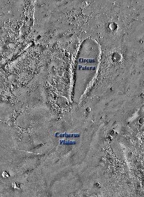
Cerberus Plains Region
 |
 |
| Mars Digital Image Mosaic from the Viking orbiter spacecraft. |
Color coded shaded relief image of MOLA high resolution topography data. Red is the highest elevation; Purple is lowest. |
Click on image to see a bigger version
Acknowlegements:
Martin Wong for producing high resolution MOLA gridded data sets.
Jim Roark for writing visualization software used to study the MOLA gridded data.
Herb Frey for onsite scientific collaboration and for hosting MARS 2000 within the Geodynamics Branch.