A new magnetic map of Mars: Programs, data, and maps
based on an in-press JGR article,
'Impact demagnetization at Mars: Using multiple altitude data to constrain crustal magnetization and impact parameters'
by Lillis et al.
Magnetic field values from correlative model (Radial, theta, phi, and scalar field values in nT) at 400 km as ascii file on a 2 degree grid.
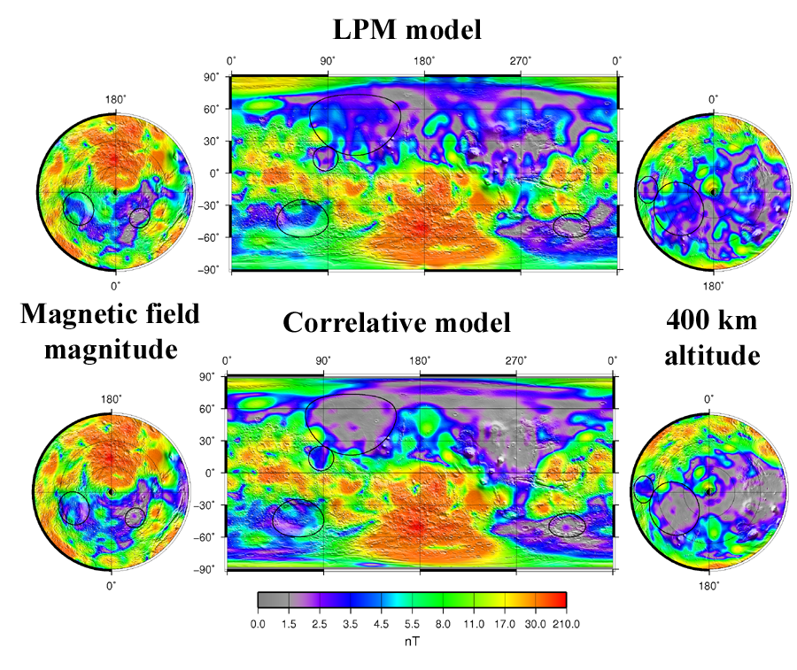
Spherical harmonic coefficients of correlative model.
Magnetic field values from LPM (Radial, theta, and phi field values in nT) at 400 km as ascii file on a 2 degree tesselation (Langlais, Purucker, and Mandea, 2004, JGR).
Topographic grid of Mars as GMT grd file
GMT program for producing magnetic map below
Martian magnetic field models compared at 400 km altitude
Corrections, additions, or changes should be sent to
Michael Purucker
at
Michael.E.Purucker@nasa.gov
Corrections, additions, and changes
Back to Geodynamics Home Page
Last updated on 19 Mar 2010